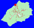
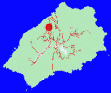
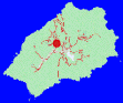
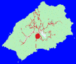
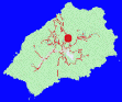
General locations on St.Helena
A brief tour of the island
St.Helena is a unique mixture of environments, ranging from the near-urban feel of Jamestown (although it is little more than a small town), to the suburban developments of Half Tree Hollow, Cow Path and New Ground, the remote village communities of Longwood and Levelwood, and the mainly rural communities of Sandy Bay and Blue Hill.
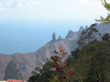
The geography is equally diverse, ranging from the lush greenery of the central peaks, to the arid desert-like areas around Properous Bay Plain, the craggy, rock-faces of Ruperts and the difficult rocky terrain that characterises most of the shorelines.
A few lines on a website cannot hope to do justice to the topic of how beautiful and varied the island of St.Helena is, but this page, hopefully, will give you some pointers to begin your search for suitable properties.
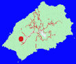
Let's start at the capital of St.Helena, Jamestown.
Until fairly recently, Jamestown was the only decently built-up area on the island. Because of the topography, Jamestown being built at the bottom of a fairly narrow valley with steep cliff-faces on both sides, there is virtually no residual opportunity for expansion, although there are some recent buildings at the very southernmost point of the town (New Bridge) which are now beginning to amalgamate Jamestown and the village of The Briars further up the valley.
Jamestown is the hub for virtually all urban-type activities on the island. Most of the St.Helena Government have their offices there, it is home to the Police headquarters, the Hospital, the Post Office, and the main hotels and most of the bars and restaurants are to be found there. In the main, night-life is Jamestown-based, and being the main port of entry, Jamestown is the focus of life when the RMS St.Helena is in port, or when cruise ships visit.
So Jamestown is a pleasant mix of places to work, commercial presence, entertainment focus and places to live. But most of the buildings in Jamestown are not modern, and many are listed.
Going up Ladder Hill
Travelling up Ladder Hill, one of the three steep roads out of Jamestown, we come to the communities of Ladder Hill, Half Tree Hollow and Cow Path, and in reality, it is no longer simple to discern the boundaries between them. In addition, recent developments in New Ground, Cleugh's Plain and Sapper Way mean that this entire northern-facing area has become the suburban centre of the island. Virtually every site in this area is on the long sloping sides of Breakneck Valley or Young's Valley, and so have impressive north-facing views of the South Atlantic Ocean, and sunsets can be breathtaking.
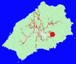
Further up, we come to St.Pauls
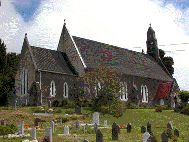
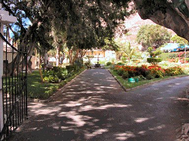
The area of St.Pauls is like a sprawling village with little that can be thought of as a centre, except, perhaps, St.Paul's Cathedral. This area is mainly rural and quiet, with few local amenities except beauty and peace and quiet. The area includes Plantation Square, where the grounds of Plantation House are to be found (and where Jonathan the multi-centenarian tortoise resides, and tolerates the presence of His Excellency the Governor of St.Helena). Most of the grounds are available for public use for extremely pleasant walks through woods and along winding country roads.
St.Pauls is also home to the Agriculture and Natural Resources Department of the St.Helena Government, which has its headquarters at Scotland. This area, together with Guinea Grass, Crack Plain and Rosemary, is one of the most attractive areas on the island.
From St.Pauls, we have the choice of heading out to Sandy Bay and Blue Hill, or going "cross-country" to Alarm Forest, which leads on to Longwood and Levelwood. Let's begin with the western side of the island.
Before too long on the road to Sandy Bay, a fork requires the traveler to choose between the destinations of Sandy Bay and the rest of the Western end of the island, centred on Blue Hill.
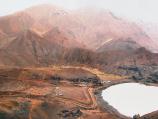
Sandy Bay is not actually on the coast as the name would imply. It is a general area which includes several small communities, including Bamboo Hedge, mainly at the head of or part-way down the Sandy Bay Valley, which eventually does reach the ocean at Sandy Bay Beach. These communities are very rural and local amenities are rare. Regular transport is provided for Jamestown and Half Tree Hollow-based workers by the main employers, but public transport is limited. However, for astounding natural beauty and seclusion, Sandy Bay is ideal.
Taking the other fork to Blue Hill...
The road to Blue Hill follows a ridge which divides the island north-south. On the southern side, the main area is uninhabited except for the Sandy Bay Valley communities. On the northern side, there are the small communities of Head o' Wain, Woodlands, Thompson's Wood, Blue Hill village and Barren Ground (which is not barren at all!) - all rural and remote.
One large area near Head o' Wain is known as Broad Bottom, and this has been of interest to an inward investor for the development of a five-star hotel and amenities complex, although, to date, little progress appears to have been made with these plans, and there is certainly no construction in the offing.
From Sandy Bay, an extremely scenic southern route around the central peaks area takes us eventually to Levelwood.
Levelwood has its own distinctive feel, and now includes several previously separate small communities, such as Taglate, Silver Hill and Woody Ridge. It's remoteness is not so much the actual distance from other areas, but the fact that approaches are very indirect, with roads diving deep into several valleys and out again, to stay on an approximately level altitude. Many sites have wonderful views to the east, which is dominated by Great Stone Top and, in the distance, the site of the proposed airport on Prosperous Bay Plain, resplendent in its multitude of colours, all changing with the dramatic light.
Some small private development is taking place at Kennedy's, in Taglate Valley between Levelwood itself and the Bellstone.
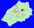
Continuing on the circuit road around the peaks, we come to Hutts Gate, which has a not insignificant number of houses spread over quite a wide area. But Hutts Gate is a sort of crossroads, where the roads from Levelwood, from Longwood, from St.Pauls and from Alarm Forest all meet. So let's first visit Longwood.
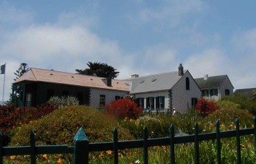
Longwood is, of course, famous for Longwood House, the final domicile of Napoleon Bonaparte. But the villagers of Longwood are generally untouched by the distinctive history. It is a relatively large, mainly self-contained community, including the village of Longwood itself, the ribbon developments of Longwood Road, at Deadwood and at Mulberry Gut, together with Bottom Woods, the road though which takes you on to Prosperous Bay Plain and the recently planted Millenium Forest.
Resuming the journey on the island circuit road from Hutts Gate, we come to Alarm Forest
Alarm Forest, which includes areas known as Seaview, Two-gun Saddle, Hunts Vale, and further down the hill, the Briars village, is located at the top of the other steep main road climb out of Jamestown, known as Side Path. It is mainly suburban, but with few amenities of its own, residents relying mainly on the relative proximity to Jamestown for shopping and entertainment.
Before completing the tour by returning to Jamestown, it is worth mentioning Ruperts valley
Ruperts Valley, culminating in Ruperts Bay, is reached by a spur road from half way up Side Path. This is where the majority of the island's industrial work goes on (though to characterise it so is somewhat of an exaggeration). But there is also a residential community here.
The plans for the airport and the Land Development Control Plan both recognise Ruperts as being the industrial centre and envisage it becoming further developed.